Planning a day out on the North Norfolk coast
On most coasts the tide decides how far you walk. On this one it decides what there is to do.
North Norfolk is a coast of tidal creeks and saltmarsh rather than open beach with a road along it. The water reaches most of these places through a winding channel, and those channels dry. A staithe that is full of boats at eleven can be mud by three, and the same quay that a seal trip leaves from is unreachable by water for much of the day.
So the question is not really where to go. Six of the seven are two different places depending on when you arrive: a harbour or a field of mud, a mile of open sand or no beach at all. Wells is the exception, because its quay works at any state of the tide.
So the useful thing to know first is not a tide time. It is which of two kinds of place you are going to, because that determines which end of the tide you want.
Two kinds of place
Five of the seven
Creeks and staithes
Burnham Overy Staithe, Brancaster Staithe, Blakeney, Morston and Wells. The water arrives by a channel that dries. Boats float, trips sail and creeks fill on the hours either side of high water.
The other two
Open sand
Holkham and Hunstanton. Nothing needs to float, so the tide governs how much ground there is. Low water is what opens these two up, and the flood is what closes them again.
Every time on this site is published as a window rather than a single minute, because a single minute is more precision than tide prediction can honestly offer. The windows differ by location, and two of the seven have no tidal station at all — their times are reasoned across from a neighbour, and the page says so.
The creek places
Five of the seven sit at the head of a channel rather than on the open shore. The sea reaches them by a winding route through saltmarsh, and that route dries. These are the places where a staithe full of boats at eleven is a field of mud by three, and where the high-water window is not a detail of the day but the shape of it.
-
Burnham Overy Staithe
Creek to Scolt Head
The staithe dries to mud at low water and fills again on the flood, which is why the dinghies, kayaks and paddleboards here work to the tide rather than to the clock. On the water it is the busiest of the five, and the traffic thins out to nothing in the hours either side of low. Scolt Head Island lies across the channel, and the tide closes that crossing — the location page sets out when.
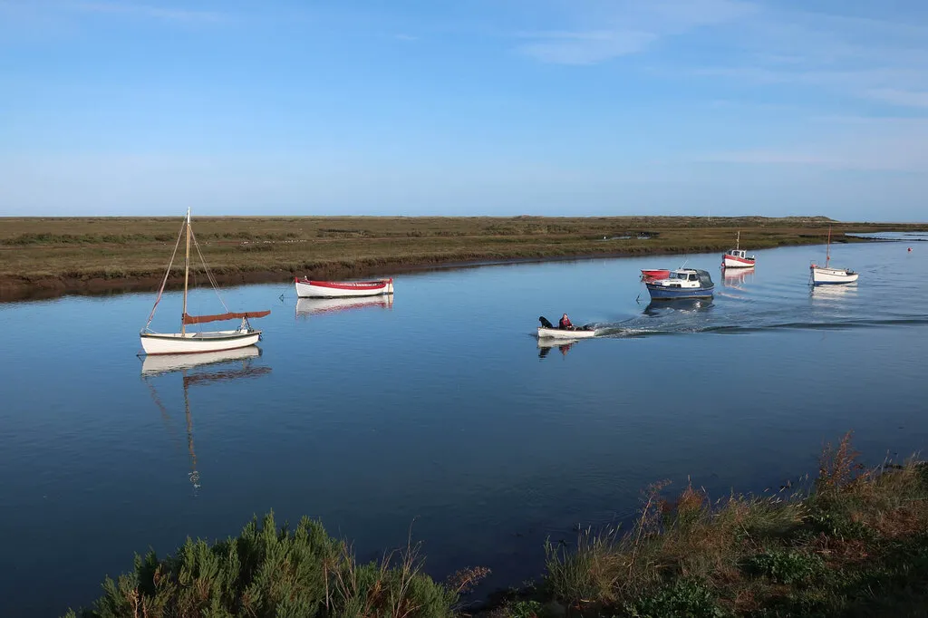
High tide
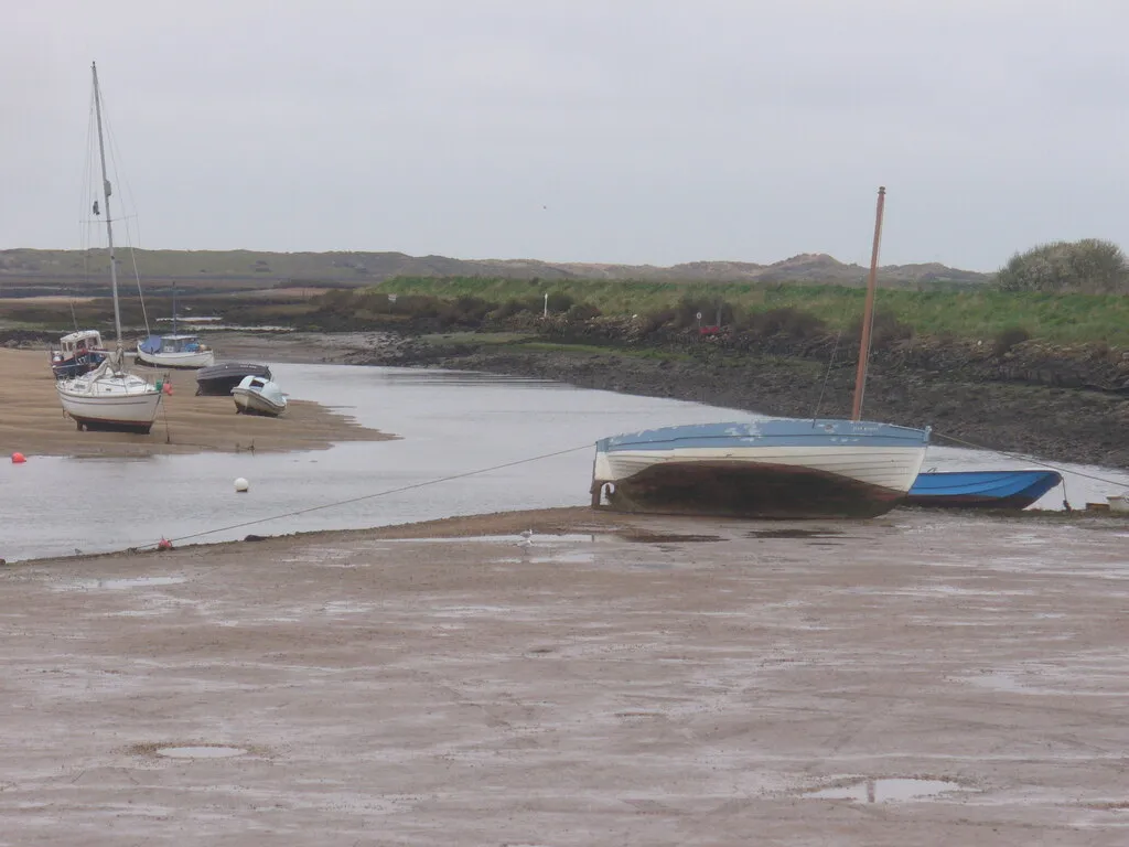
Low tide
Overy Creek at high water and at low water. The dinghies, kayaks and paddleboards that launch here work to the first picture. Photographs of Burnham Overy Staithe: Boat approaching Burnham Overy by Hugh Venables · Overy Creek, Low Tide by Colin Smith · CC BY-SA 2.0 Nearby: The Hero, Burnham Overy Island Ferry.
-
Wells-next-the-Sea
The harbour channel
A working harbour with a long channel between the quay and open sea, so keelboats and trip boats move on the high-water window rather than whenever suits. The quay stays a quay all day — this is the one location on the list where the tide does not decide whether there is anything to do — but what is afloat in front of it changes completely. It is also the only location on this site with a tide gauge, which makes its timing the one figure here that has been calibrated against measurement rather than reasoned.
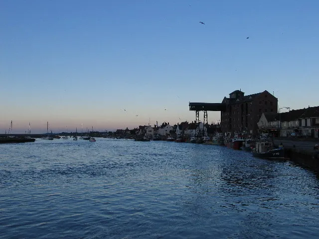
High tide
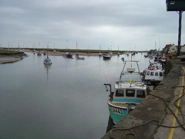
Low tide
The same view down the harbour channel at Wells, full and empty. Keelboats and trip boats move on the first. Photographs of Wells-next-the-Sea: Wells-next-the-Sea harbour at full tide by Trevor Wright · Harbour, Wells-Next-the-Sea by Ian Lavender · CC BY-SA 2.0 Nearby: The Globe Inn, The Crown Hotel.
-
Brancaster Staithe
Mussel beds & the harbour
The channel runs out past the mussel beds toward Scolt Head, and this is a working harbour as much as a sailing one. At low water the route to the quay narrows to a trickle marked by withies pushed into the mud; on the flood it is deep enough to take the fishing boats back in. Boats and crabbing key off the same high-water window, and the car park is the detail the location page picks up.
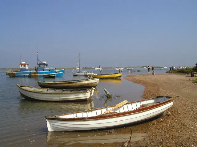
High tide
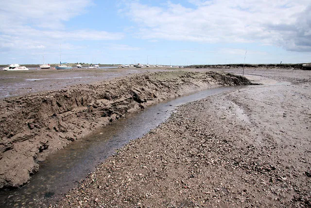
Low tide
The channel out past the mussel beds, and the same channel at low water. The photographer’s note records that its route is marked by withies — willow branches pushed into the mud. Photographs of Brancaster Staithe: High tide at Brancaster Staithe by John Brightley · Low water channel by Bob Jones · CC BY-SA 2.0 Nearby: The White Horse, Marshside.
-
Blakeney
The Glaven channel
The Glaven channel winds down through saltmarsh toward Blakeney Point, and the small boats moored along it float only near high water. Seal trips run from the quay here, which is why the sailing times move through the day rather than staying put. What a big spring tide does to that quay is recorded on the location page.
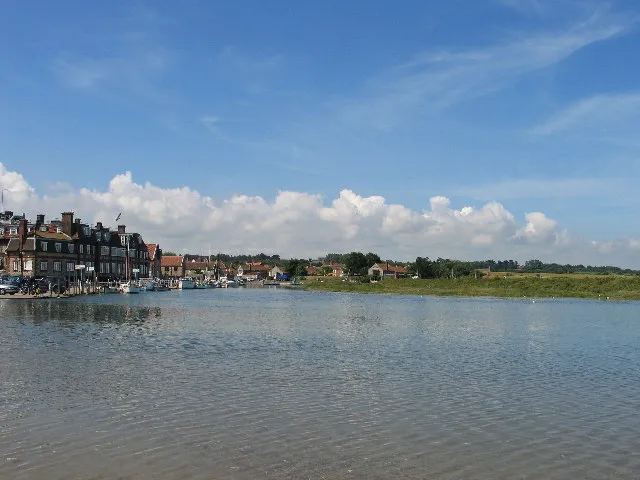
High tide
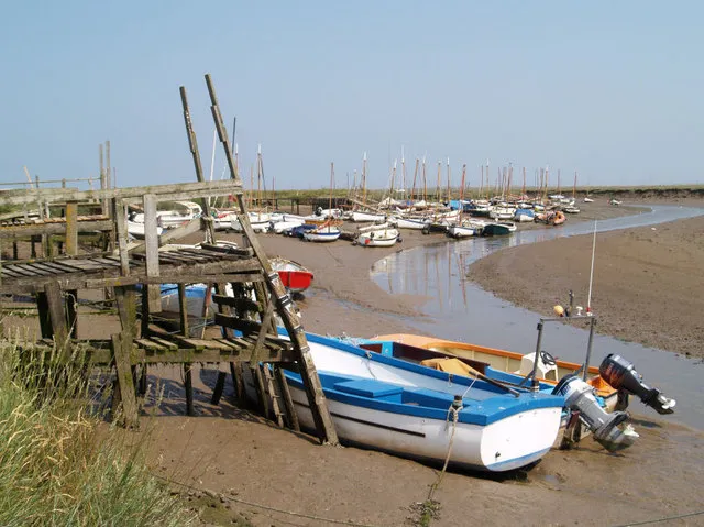
Low tide
Blakeney harbour full, and the same harbour drained back to its creek. The boats moored along the Glaven float only near the top of the tide. Photographs of Blakeney: Blakeney at high tide by Trevor Wright · Low tide at Blakeney by Steve Fareham · CC BY-SA 2.0 Nearby: The White Horse, The Kings Arms.
-
Morston
Quay for the Point
Morston Quay is where most of the Blakeney Point seal boats actually leave from, and the creek serving it dries, so sailings are set by the tide rather than by the hour. Its landing stages stand on legs for a reason: at the bottom of a spring tide the water is a long way below the boards. There is no tidal station at Morston of any kind — its timing is reasoned across from Blakeney, a short way up the same harbour.
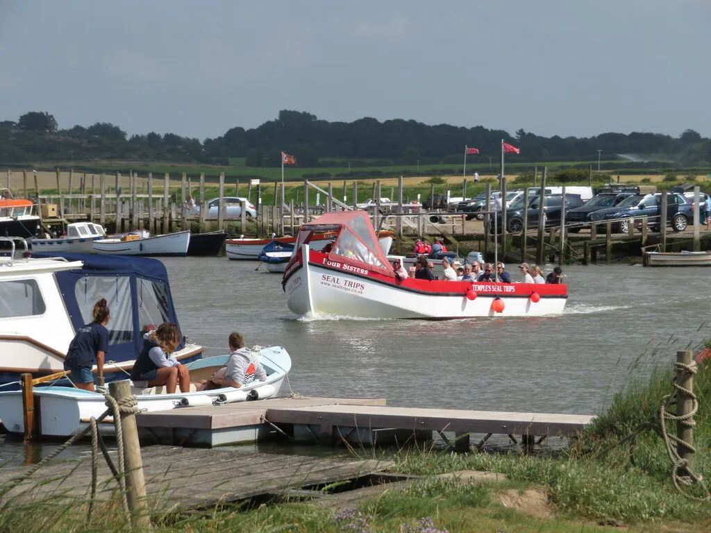
High tide
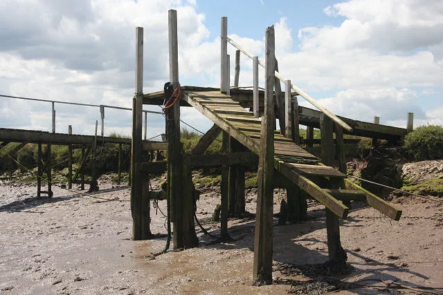
Low tide
A seal trip leaving Morston, and one of the quay’s landing stages at low water. The photographer titled the second one “Landing stage - to thin air”. Photographs of Morston: Boats on Morston Creek by Gareth James · Landing stage - to thin air by Bob Jones · CC BY-SA 2.0 Nearby: The Anchor Inn, Temple's Seal Trips.
The open sand
The other two work the other way round. Here the tide does not decide whether you can float — it decides how much beach exists. Low water is the event: it is what opens the ground up and hands over the distances these two places are known for. The flood is what takes them back.
-
Holkham Beach
Gap, pines & vast sands
Holkham Gap opens through the pines onto sand that runs out for a long way at low water, across ground flat enough that the channels behind you fill as the flood comes in. The distance between the pines and the sea is the thing people come for, and it is a distance that only exists for part of the day. There is no tidal station here either, which is why the window on the Holkham page is ±40 minutes, as at Hunstanton and wider than the other five.
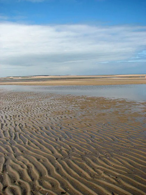
Low tide
Holkham on a large ebb. There is no companion picture at high water because there is nothing to photograph — the sand in this frame is under the sea. Photographs of Holkham Beach: Holkham Beach during a large ebb tide by Evelyn Simak · CC BY-SA 2.0 Nearby: The Victoria Inn, Holkham Hall estate.
-
Hunstanton
Striped cliffs, west-facing
The coast turns the corner into The Wash here, which is why Hunstanton faces west and is the one town on this side of the country that watches the sun set over the sea. The banded chalk and carrstone cliffs are the other reason people come, and how close you can get to them depends on where the tide is. The Wash does not behave like the North Norfolk creeks — the location page is blunt about that.
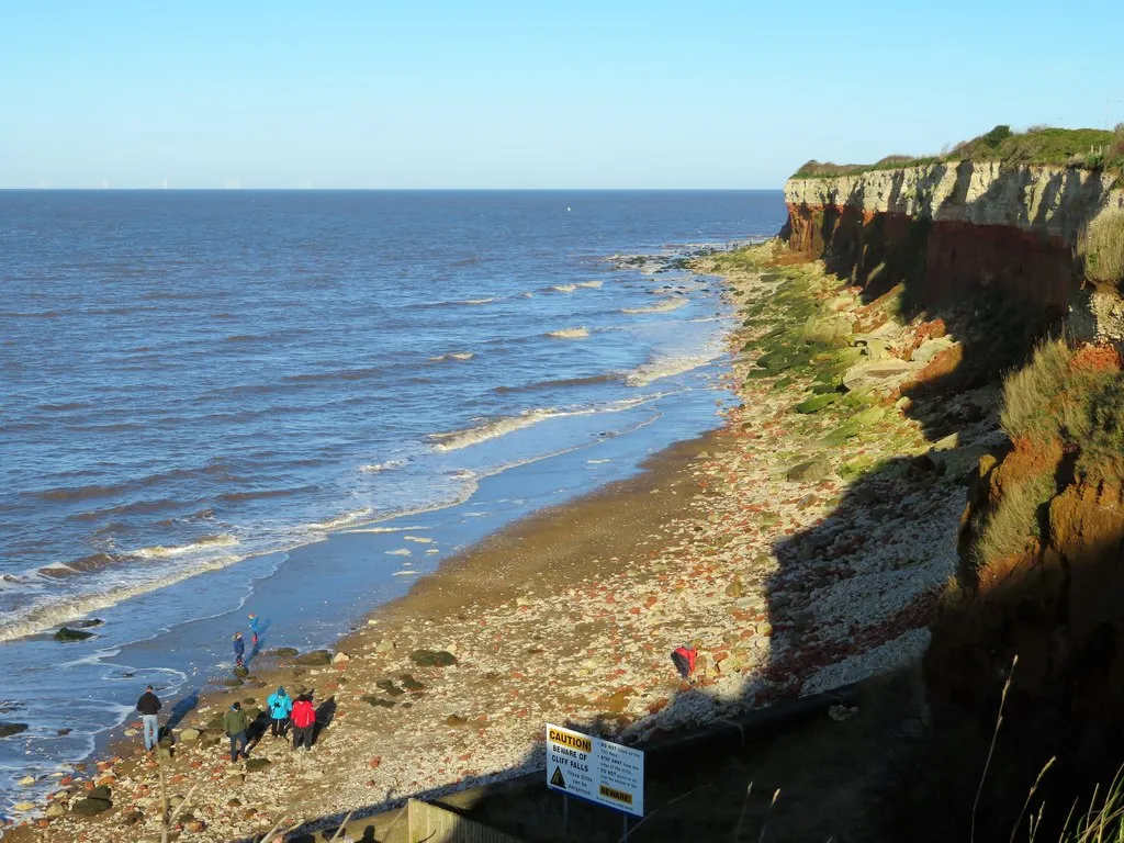
High tide
Low tide
The striped cliffs with the sea against them, and The Wash at low water. The two specks in the second picture are people. Photographs of Hunstanton: High tide at Hunstanton cliffs by Richard Humphrey · Low tide, Hunstanton beach by Robin Webster · CC BY-SA 2.0 Nearby: Hunstanton Watersports, Searles Leisure Resort.
Questions the tide answers
- Why do the seal trips leave at a different time every day?
- Because they are timed off high water, and high water is not timed off the clock. There are two high waters a day and each is roughly fifty minutes later than the one before, so a sailing that goes at ten this morning goes at getting on for eleven tomorrow. The creek at Morston dries; the boats need water under them to reach the Point at all. See the Morston times
- When is Holkham beach at its biggest?
- At low water, and the difference is not marginal — this is the location where the tide governs how much beach exists rather than whether the boats float. Holkham has no tidal station of its own, so its times are reasoned rather than measured, and the window here is ±40 minutes, wider than at five of the seven. See the Holkham Beach times
- Can you get out to Blakeney Point?
- By boat, yes, and that is the part the tide governs: the trips run from Morston Quay and from Blakeney, and they sail on the high-water window because the channels serving both dry out. Anything on foot is a question about ground and distance rather than about tide tables, and this site has no basis for answering it — the Blakeney page’s “Dangers here” section is the sourced place to look. See the Blakeney times
- Which of the seven is worth a visit at low tide?
- Holkham and Hunstanton, where low water is the whole point. At the five creek locations low water is when the boats are aground and the channel is mud — which some people come specifically to see, and which is the state most of these places spend most of the day in.
- Do these times work for the whole North Norfolk coast?
- No, and the differences are larger than they look for a coast this short. Each location has its own offset and its own confidence window, and two of the seven have no tidal station at all, so their times are reasoned across from a neighbour rather than measured. Each page shows which it is.
Before you go
Each location page carries a “Dangers here” section specific to that place, with a source against every claim. What the tide does at Holkham is not what it does at Blakeney, and the places where a mistake matters most are not the ones that look most dramatic.
These are predictions of the astronomical tide. They cannot know what the weather is doing, and wind, pressure and surge all move real water. How these times are worked out.