Morston tide times
The quay where the Blakeney Point seal boats run. Access and moorings live and die by the tide.
Print Now (Free)Next high tideHigh tide now · Morston
BST ±30 min
The next high tide at Morston is 03:25 BST ±30 min on Wed 21 Oct.
Tide predictions for Morston have run out. Reload the page for the latest.
Morston tide table: next 7 days, high and low tide
times in BST · high ±30 · low ±60| Day | Early | Late |
|---|---|---|
| Wed 21 Oct ☀ 07:33–17:47 Neap | 03:25 5.5 m 10:28 low | 16:33 5.6 m 23:05 low |
| Thu 22 Oct ☀ 07:35–17:45 Neap | 04:39 5.9 m 11:31 low | 17:26 6.0 m 23:55 low |
| Take Morston with you This week’s high tides on one A4 page, for the fridge or the boot. No card, no account. Download the free tide tableLonger, with a calendar file: 1 month £23 months £56 months £1012 months £20 | ||
| Fri 23 Oct ☀ 07:37–17:43 Mid | 05:26 6.3 m | 18:02 6.5 m 12:13 low |
| Sat 24 Oct ☀ 07:38–17:41 Spring | 06:09 6.8 m 00:35 low | 18:41 6.9 m 12:54 low |
| Sun 25 Oct ☀ 06:40–16:39 Spring | 05:51 7.1 m 01:15 low | 18:19 7.2 m 12:34 low |
| Mon 26 Oct ☀ 06:42–16:37 Spring | 06:30 7.3 m 00:53 low | 18:56 7.3 m 13:12 low |
| Tue 27 Oct ☀ 06:44–16:35 Spring | 07:10 7.5 m 01:32 low | 19:34 7.4 m 13:51 low |
Two high waters most days, roughly twelve hours apart. Each high water is accurate to ±30 min. Low water is worked out from the high waters either side of it, so it is a wider estimate — ±60 min — and is shown smaller for that reason. “Spring” tides run higher and faster than “neap”.
Heights are the size of the tide, not the depth of the water here. They are metres above chart datum at Immingham, our reference port — we carry a timing offset to Morston but no height ratio, so a big number does not mean a deep creek.
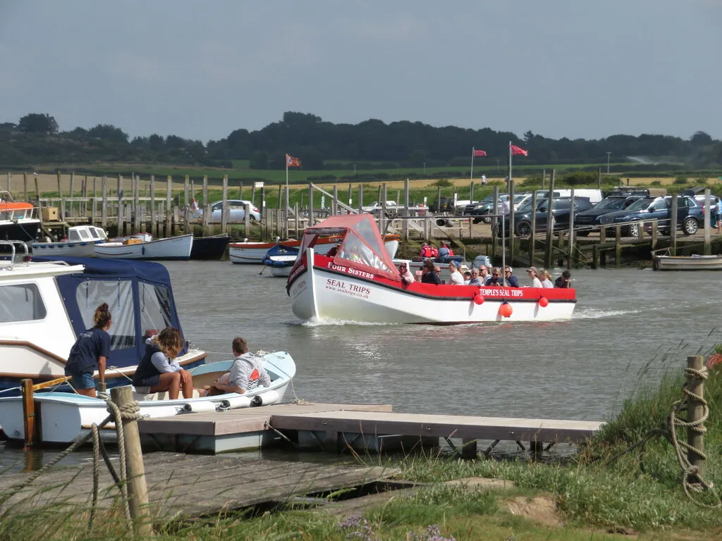
High tide
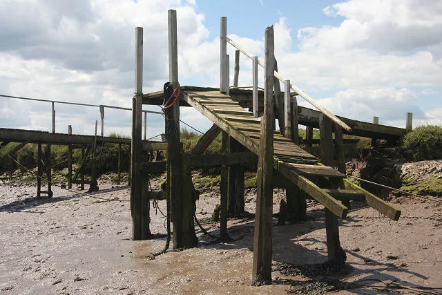
Low tide
What the tide controls here
At Morston, the tide controls when the seal boats run, when boats can reach the quay, and whether the quayside car park floods.
- Seal trips
- Departure times move with the tide every day. Beans Boats ask you to arrive 30 minutes before your slot. Beans Boat Trips →
- Quay access
- The Blakeney Harbour Association put access to Morston Quay at about two hours either side of high water, for shoal-draft boats. Blakeney Harbour Association →
- Parking
- The National Trust warn the quayside car parks are liable to flooding — take note of the signs on a big tide. National Trust →
- Flood warnings
- The Environment Agency issues tidal flood warnings for this stretch of coast. Check live warnings →
Wind, and what it does to these times
ECMWF IFS 0.25° · issued Tue 13:00At high water
- Wind
- Force 4 SW13 kn, gusting 19
- Rain
- Dry0.00 mm this window
- Sea
- 0.9 m6s period
- Temp
- 11°C8% cloud
Expect the water to be higher than the prediction alone.
Pressure is 1000.5 hPa — on its own worth roughly 13 cm of extra height.
Humidity 92%.
Fog risk: possible.
At low water
- Wind
- Force 4 SSE12 kn, gusting 15
- Rain
- Dry0.00 mm this window
- Sea
- 0.7 m5s period
- Temp
- 12°C78% cloud
Expect the water to be close to the prediction. The wind is pushing water back out, so this may run to the later part of the window.
Pressure is 998.9 hPa — on its own worth roughly 14 cm of extra height.
Humidity 87%.
Fog risk: possible.
This does not move the times above. We publish a window rather than a single minute precisely because weather moves real water, and we have never measured how far it moves it here. Which half of the window to lean toward is a judgement, not a calculation. How we work these out
SW force 413 kn at high water · full forecast
| Time | Direction | Force | Knots | Rain | Sea |
|---|---|---|---|---|---|
| 13:00Tue | ESE | 5 | 19 | — | 1.5 m |
| 16:00Tue | ESE | 5 | 20 | Drizzle | 1.5 m |
| 19:00Tue | SE | 4 | 13 | Raining | 1.3 m |
| 22:00Tue | SSE | 3 | 9 | Drizzle | 1.1 m |
| 01:00Wed | SW | 4 | 12 | Drizzle | 0.9 m |
| 04:00Wed | SW | 4 | 13 | Dry | 0.9 m |
| 07:00Wed | SSE | 3 | 10 | Dry | 0.8 m |
| 10:00Wed | SSE | 4 | 12 | Dry | 0.7 m |
| 13:00Wed | SE | 4 | 11 | Drizzle | 0.6 m |
| 16:00Wed | WSW | 5 | 18 | Raining | 0.7 m |
| 19:00Wed | SW | 5 | 20 | Drizzle | 0.9 m |
| 22:00Wed | W | 7 | 27 | Drizzle | 1.5 m |
| 01:00Thu | WSW | 6 | 21 | Drizzle | 1.3 m |
| 04:00Thu | SW | 4 | 15 | Dry | 0.9 m |
| 07:00Thu | SW | 3 | 10 | Dry | 0.6 m |
| 10:00Thu | WSW | 3 | 10 | Dry | 0.5 m |
| 13:00Thu | WSW | 4 | 12 | Dry | 0.5 m |
| 19:00Thu | S | 3 | 7 | Dry | 0.5 m |
| 01:00Fri | SE | 4 | 14 | Dry | 0.6 m |
| 07:00Fri | SE | 5 | 19 | Raining | 1.0 m |
| 13:00Fri | ESE | 4 | 14 | Drizzle | 0.8 m |
Outlook: days 4–7coarser sample, less certain
| Time | Direction | Force | Knots | Rain | Sea |
|---|---|---|---|---|---|
| 19:00Fri | WNW | 7 | 30 | Raining | 0.7 m |
| 01:00Sat | WNW | 7 | 29 | Drizzle | 2.1 m |
| 07:00Sat | W | 5 | 21 | Dry | 1.6 m |
| 13:00Sat | SW | 4 | 15 | Dry | 1.0 m |
| 19:00Sat | S | 5 | 20 | Raining | 0.9 m |
| 01:00Sun | WSW | 5 | 20 | Drizzle | 0.9 m |
| 06:00Sun | WSW | 5 | 20 | Dry | 1.1 m |
| 12:00Sun | W | 6 | 25 | Dry | 1.4 m |
| 18:00Sun | W | 6 | 22 | Drizzle | 1.4 m |
| 00:00Mon | WSW | 5 | 17 | Dry | 1.0 m |
| 06:00Mon | SW | 4 | 12 | — | 0.8 m |
| 12:00Mon | SSE | 4 | 14 | Dry | 0.7 m |
| 18:00Mon | SSW | 5 | 20 | Drizzle | 1.0 m |
| 00:00Tue | SSW | 6 | 24 | Dry | 1.2 m |
| 06:00Tue | WSW | 6 | 22 | Drizzle | 1.3 m |
| 12:00Tue | WSW | 5 | 18 | Dry | 0.9 m |
Rows past the first three days are an outlook, not a forecast — the model publishes them at half the resolution and they are far more likely to change before the day arrives.
⚠️ A 0.25° grid is roughly one cell for this coast. These are the conditions over the area, not the wind in a particular creek. A forecast is not an observation, and this one is a snapshot taken when the page was built — check a live marine forecast before going afloat. Contains modified Copernicus/ECMWF forecast data.
Morston · monthly
Morston tide table, on your fridge every month
A printable A4 tide table for Morston arrives in your inbox on the 28th, for the month ahead. Print it, stick it up, stop checking.
- Today this month’s table
- 28th next month’s
- Monthly until you cancel
£2 a month · cancel any time
15% of people in the UK and Ireland have been cut off — or nearly cut off — by the tide in their lifetime (RNLI/Bangor University, April 2025).
Just one month? Buy a single table, £2 Not sure? Print this week free
Dangers here
Specific to this location. The sea is dangerous everywhere on this coast — this is what the tide does here.
The quayside car park floods
The National Trust warn that the quayside car parks are liable to flooding and ask visitors to take note of the signs. On a big tide, where you leave the car matters.
How this time is worked out
Every time on this page is high water at Immingham, shifted by 62 minutes for Morston, and published as a ±30 minute window.
Worked out from nearby coast. Not checked against a tide gauge directly — there is no gauge here. Derived from Wells, the only location on this coast we can check directly: this timing shares Wells’ gauge-measured, tide-size-dependent correction rather than having its own. Morston’s tidal creek is longer than Wells’, so this assumption is weaker here than elsewhere on this coast.
How we work out every time on this site
This is a prediction of the astronomical tide. It cannot know what the weather is doing, and wind, pressure and surge all move real water. It is one input to a decision you make — never the decision itself.
Put Morston tides on your site
Free for any local business. One line of code, and it keeps itself current.
Card
Sticker
Show the code
Things to do at Morston
The Anchor Inn
Grade II listed flint pub with a quayside restaurant, run by the Temple family since the 19th century.
Temple's Seal Trips
Seal-watching boat trips to Blakeney Point, ticket office inside the Anchor Inn.
Nobody pays to be on this list. Check opening times before you set off. Want your business here? See how it works or email ahoy@norfolktidetimes.co.uk.
Generated 21 October 2026 · TICON-4 harmonic constants via @neaps/tide-database (CC-BY-4.0, Hart-Davis et al., 2025)
What the tide allows here
All activities- Seal trips
Next window here
01:25–05:25
Wed 21 Oct
- Birdwatching
Next window here
14:33–17:47
Wed 21 Oct
Windows are published by the clubs, harbours and operators named on each activity page — not by us. Always use your own judgement, and ask whoever you are hiring from.