Burnham Overy Staithe tide times
A winding tidal creek — the launch for dinghies, kayaks and paddleboards heading out toward Scolt Head Island.
Print Now (Free)Next high tideHigh tide now · Burnham Overy Staithe
BST ±30 min
The next high tide at Burnham Overy Staithe is 03:10 BST ±30 min on Wed 21 Oct.
Tide predictions for Burnham Overy Staithe have run out. Reload the page for the latest.
Burnham Overy Staithe tide table: next 7 days, high and low tide
times in BST · high ±30 · low ±60| Day | Early | Late |
|---|---|---|
| Wed 21 Oct ☀ 07:34–17:48 Neap | 03:10 5.5 m 10:13 low | 16:18 5.6 m 22:50 low |
| Thu 22 Oct ☀ 07:36–17:46 Neap | 04:24 5.9 m 11:16 low | 17:11 6.0 m 23:40 low |
| Take Burnham Overy Staithe with you This week’s high tides on one A4 page, for the fridge or the boot. No card, no account. Download the free tide tableLonger, with a calendar file: 1 month £23 months £56 months £1012 months £20 | ||
| Fri 23 Oct ☀ 07:38–17:44 Mid | 05:11 6.3 m 11:58 low | 17:47 6.5 m |
| Sat 24 Oct ☀ 07:39–17:42 Spring | 05:54 6.8 m 00:20 low | 18:26 6.9 m 12:39 low |
| Sun 25 Oct ☀ 06:41–16:40 Spring | 05:36 7.1 m 01:00 low | 18:04 7.2 m 12:19 low |
| Mon 26 Oct ☀ 06:43–16:38 Spring | 06:15 7.3 m 00:38 low | 18:41 7.3 m 12:57 low |
| Tue 27 Oct ☀ 06:45–16:36 Spring | 06:55 7.5 m 01:17 low | 19:19 7.4 m 13:36 low |
Two high waters most days, roughly twelve hours apart. Each high water is accurate to ±30 min. Low water is worked out from the high waters either side of it, so it is a wider estimate — ±60 min — and is shown smaller for that reason. “Spring” tides run higher and faster than “neap”.
Heights are the size of the tide, not the depth of the water here. They are metres above chart datum at Immingham, our reference port — we carry a timing offset to Burnham Overy Staithe but no height ratio, so a big number does not mean a deep creek.
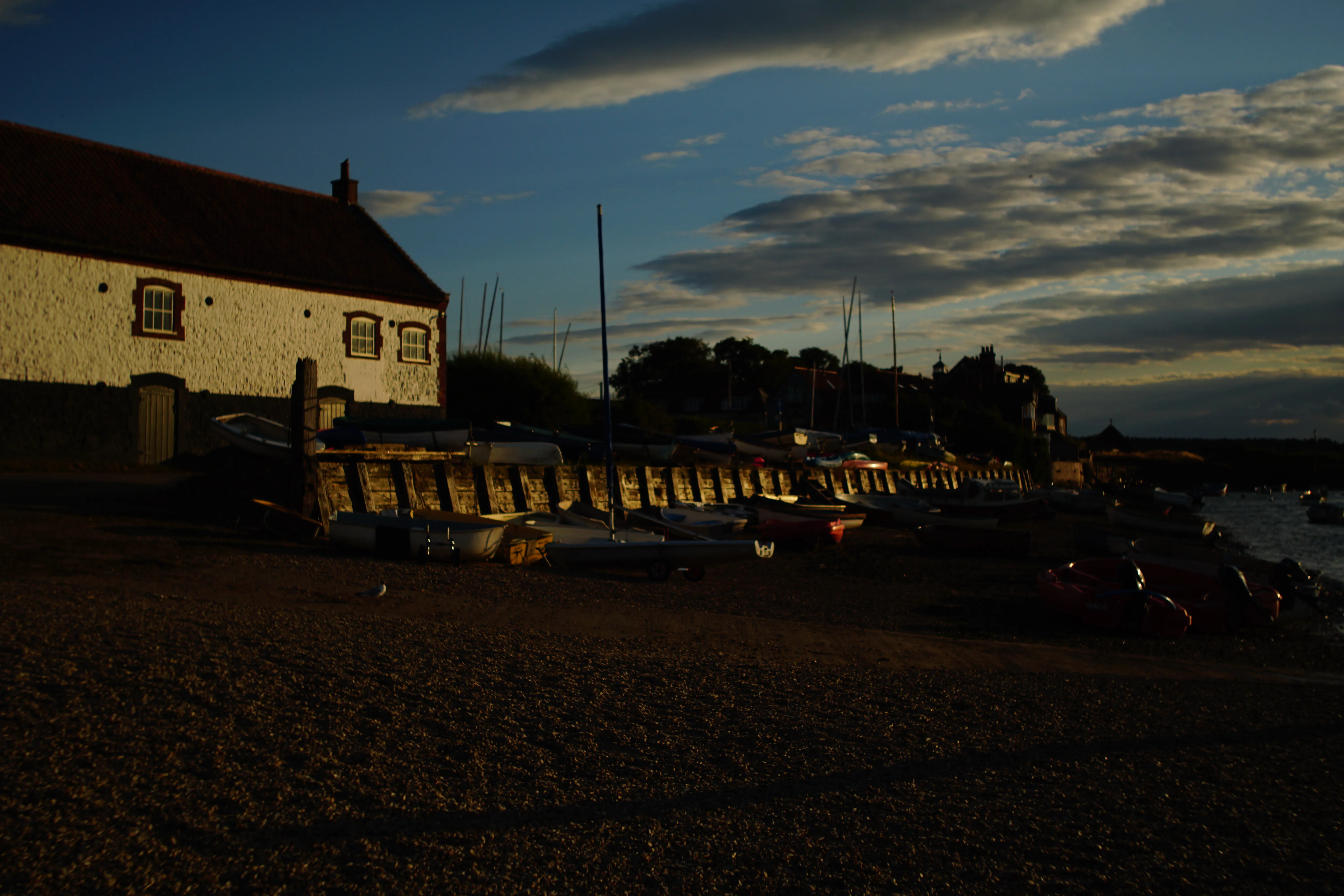
Heading out to Scolt Head Island? These are the low tides that crossing hangs off, and the ferry runs from this staithe.
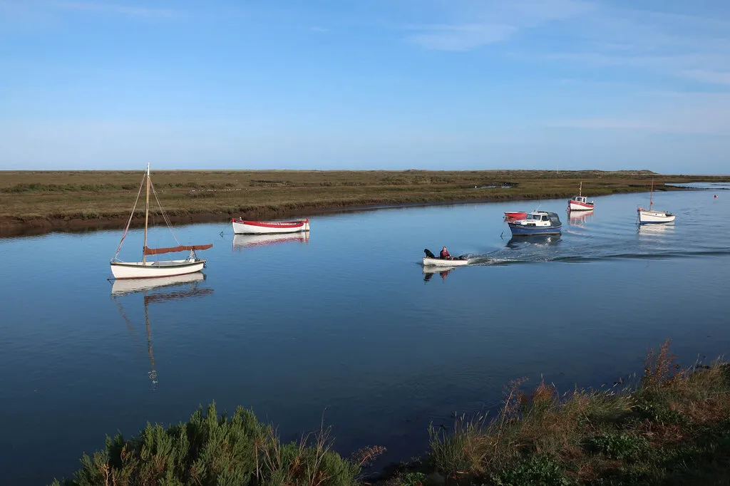
High tide
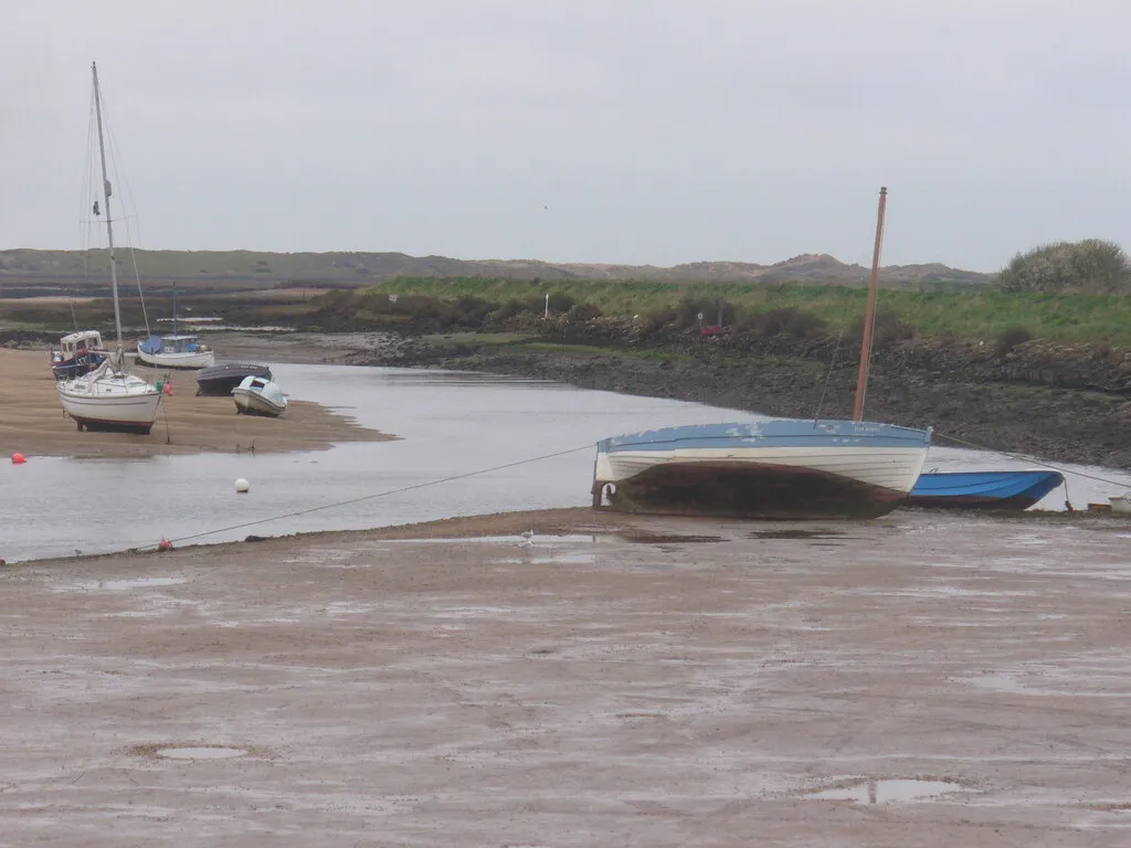
Low tide
What the tide controls here
At Burnham Overy Staithe, the tide controls when the Scolt Head Island ferries can run and when boats can get up and down the creek.
- Scolt Head ferry
- Two licensed ferries run to the island, normally two hours either side of high tide in daylight hours. Burnham Overy Boathouse →
- Season
- The ferries are seasonal, running April to September. Natural England →
- Your own boat
- Natural England refer anyone reaching the island in their own vessel to the Brancaster Harbour Launch and General Directions. Natural England →
- Flood warnings
- The Environment Agency issues tidal flood warnings for this stretch of coast. Check live warnings →
Wind, and what it does to these times
ECMWF IFS 0.25° · issued Tue 13:00At high water
- Wind
- Force 4 SW12 kn, gusting 20
- Rain
- Dry0.06 mm this window
- Sea
- 0.7 m6s period
- Temp
- 10°C5% cloud
Expect the water to be higher than the prediction alone.
Pressure is 1000.4 hPa — on its own worth roughly 13 cm of extra height.
Humidity 92%.
Fog risk: possible.
At low water
- Wind
- Force 4 SSE11 kn, gusting 18
- Rain
- Dry0.00 mm this window
- Sea
- 0.5 m6s period
- Temp
- 12°C88% cloud
Expect the water to be close to the prediction. The wind is pushing water back out, so this may run to the later part of the window.
Pressure is 998.6 hPa — on its own worth roughly 15 cm of extra height.
Humidity 84%.
This does not move the times above. We publish a window rather than a single minute precisely because weather moves real water, and we have never measured how far it moves it here. Which half of the window to lean toward is a judgement, not a calculation. How we work these out
SW force 412 kn at high water · full forecast
| Time | Direction | Force | Knots | Rain | Sea |
|---|---|---|---|---|---|
| 13:00Tue | ESE | 5 | 16 | — | 1.1 m |
| 16:00Tue | ESE | 4 | 14 | Drizzle | 1.1 m |
| 19:00Tue | ESE | 3 | 10 | Raining | 1.0 m |
| 22:00Tue | S | 2 | 7 | Drizzle | 0.8 m |
| 01:00Wed | SW | 3 | 11 | Dry | 0.7 m |
| 04:00Wed | SW | 4 | 12 | Dry | 0.7 m |
| 07:00Wed | SSE | 3 | 9 | Dry | 0.6 m |
| 10:00Wed | SSE | 4 | 11 | Dry | 0.5 m |
| 13:00Wed | SE | 3 | 8 | Drizzle | 0.5 m |
| 16:00Wed | SW | 5 | 16 | Drizzle | 0.6 m |
| 19:00Wed | SW | 5 | 19 | Dry | 0.8 m |
| 22:00Wed | W | 6 | 25 | Drizzle | 1.2 m |
| 01:00Thu | WSW | 5 | 20 | Drizzle | 1.0 m |
| 04:00Thu | SW | 4 | 15 | Dry | 0.7 m |
| 07:00Thu | SW | 3 | 9 | Dry | 0.4 m |
| 10:00Thu | WSW | 3 | 9 | Dry | 0.4 m |
| 13:00Thu | WSW | 4 | 11 | Dry | 0.4 m |
| 19:00Thu | S | 2 | 6 | Dry | 0.4 m |
| 01:00Fri | ESE | 4 | 13 | Drizzle | 0.4 m |
| 07:00Fri | SE | 5 | 19 | Raining | 0.7 m |
| 13:00Fri | ESE | 4 | 13 | Drizzle | 0.6 m |
Outlook: days 4–7coarser sample, less certain
| Time | Direction | Force | Knots | Rain | Sea |
|---|---|---|---|---|---|
| 19:00Fri | WNW | 7 | 28 | Raining | 0.7 m |
| 01:00Sat | WNW | 6 | 24 | Dry | 1.5 m |
| 07:00Sat | W | 5 | 18 | Dry | 1.2 m |
| 13:00Sat | SW | 4 | 14 | Dry | 0.8 m |
| 19:00Sat | S | 5 | 20 | Raining | 0.8 m |
| 01:00Sun | WSW | 5 | 20 | Drizzle | 0.7 m |
| 06:00Sun | WSW | 5 | 21 | Dry | 0.9 m |
| 12:00Sun | W | 6 | 23 | Dry | 1.1 m |
| 18:00Sun | W | 5 | 20 | Dry | 1.0 m |
| 00:00Mon | WSW | 4 | 15 | Dry | 0.8 m |
| 06:00Mon | SW | 4 | 11 | Dry | 0.6 m |
| 12:00Mon | SSE | 4 | 12 | Dry | 0.5 m |
| 18:00Mon | SSW | 5 | 20 | Drizzle | 0.7 m |
| 00:00Tue | SSW | 6 | 24 | Dry | 0.9 m |
| 06:00Tue | WSW | 6 | 22 | Drizzle | 1.0 m |
| 12:00Tue | WSW | 5 | 17 | Dry | 0.8 m |
Rows past the first three days are an outlook, not a forecast — the model publishes them at half the resolution and they are far more likely to change before the day arrives.
⚠️ A 0.25° grid is roughly one cell for this coast. These are the conditions over the area, not the wind in a particular creek. A forecast is not an observation, and this one is a snapshot taken when the page was built — check a live marine forecast before going afloat. Contains modified Copernicus/ECMWF forecast data.
Burnham Overy Staithe · monthly
Burnham Overy Staithe tide table, on your fridge every month
A printable A4 tide table for Burnham Overy Staithe arrives in your inbox on the 28th, for the month ahead. Print it, stick it up, stop checking.
- Today this month’s table
- 28th next month’s
- Monthly until you cancel
£2 a month · cancel any time
15% of people in the UK and Ireland have been cut off — or nearly cut off — by the tide in their lifetime (RNLI/Bangor University, April 2025).
Just one month? Buy a single table, £2 Not sure? Print this week free
Dangers here
Specific to this location. The sea is dangerous everywhere on this coast — this is what the tide does here.
Scolt Head Island is cut off by the tide
Scolt Head is an island, reached by ferry and only on the tide. In August 2025 the RNLI launched to six people trapped there. If you cross, know when the last boat runs.
How this time is worked out
Every time on this page is high water at Immingham, shifted by 47 minutes for Burnham Overy Staithe, and published as a ±30 minute window.
Worked out from nearby coast. Not checked against a tide gauge directly — there is no gauge here. Derived from Wells, the only location on this coast we can check directly: this timing shares Wells’ gauge-measured, tide-size-dependent correction rather than having its own.
How we work out every time on this site
This is a prediction of the astronomical tide. It cannot know what the weather is doing, and wind, pressure and surge all move real water. It is one input to a decision you make — never the decision itself.
Put Burnham Overy Staithe tides on your site
Free for any local business. One line of code, and it keeps itself current.
Card
Sticker
Show the code
Things to do at Burnham Overy Staithe
The Hero
Laid-back, dog-friendly harbour village pub with rooms, wood burner and locally sourced seasonal menus.
Burnham Overy Island Ferry
Seasonal small-boat ferry from the Staithe quay to Scolt Head Island, running roughly every 20-30 minutes in summer.
Gurneys Fish Shop
Fourth-generation Burnham Market fishmonger selling fresh and oak-smoked fish, shellfish and famous fishcakes.
Socius
AA Restaurant of the Year 2022 in Burnham Market, serving modern British small plates designed to share.
The Hoste
Historic 17th-century Burnham Market inn, hotel and spa with a Nelson connection, 62 rooms and an award-winning restaurant.
Nobody pays to be on this list. Check opening times before you set off. Want your business here? See how it works or email ahoy@norfolktidetimes.co.uk.
Generated 21 October 2026 · TICON-4 harmonic constants via @neaps/tide-database (CC-BY-4.0, Hart-Davis et al., 2025)
What the tide allows here
All activities- Paddleboarding
Next window here
14:18–17:48
Wed 21 Oct
- Sailing
Next window here
14:18–17:48
Wed 21 Oct
Windows are published by the clubs, harbours and operators named on each activity page — not by us. Always use your own judgement, and ask whoever you are hiring from.